
Designing a minor (underground) drainage system is the foundational step in creating an effective Dual-Drainage model using VO SWMM.
This post highlights five key tools within VO SWMM that streamline and enhance the design process, making it efficient and user-friendly.
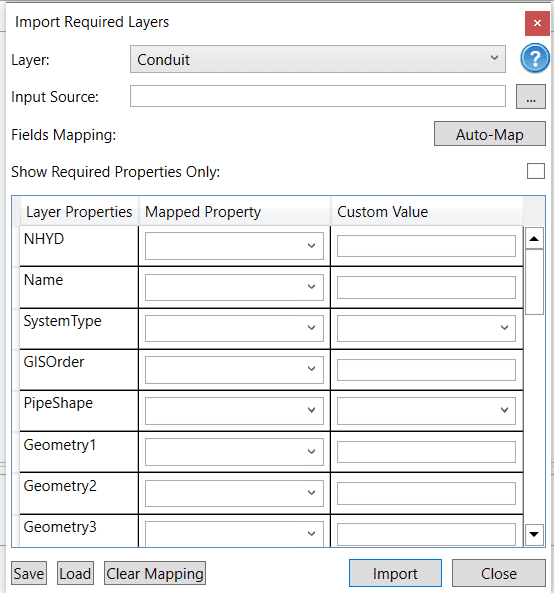
Tool #1: Import Layer
The “Import Layer” feature under the “Micro-Drainage” tab empowers users to seamlessly integrate minor (sewer) systems directly from shapefiles. This tool not only simplifies the import process but also allows for the assignment of custom values to layer properties, ensuring precision and flexibility in your design.
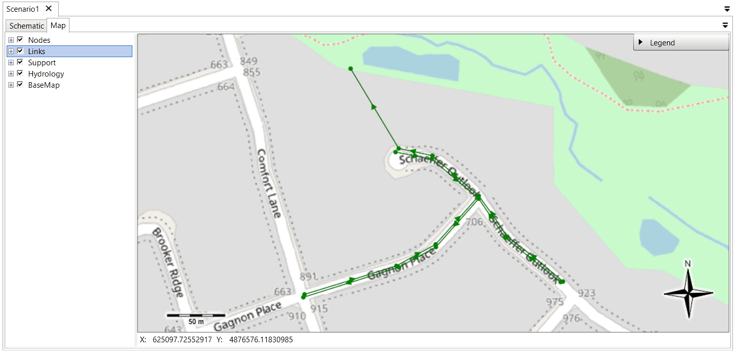
Once imported, the minor system layer is easily accessible under the “Map” tab, providing a clear visual reference for further design work.
Tool #2: Project Default Values
Manually inputting detailed properties for each component in a drainage system can be both labor-intensive and error-prone. VO SWMM addresses this challenge with its Project Default Values feature, which allows users to establish default settings for critical properties across the entire model.
This tool is indispensable for those starting a model from scratch without a GIS layer, as it automatically applies predefined values to new components, saving time and ensuring uniformity. Key parameters include:
1. Node Max Depth: Standardize the maximum depth for all nodes.
2. Conduit Roughness: Set a consistent roughness value across all conduits.
3. Pipe Shape: Choose a default pipe shape—circular, rectangular, or elliptical.
3. System Type: Define the primary function of the network, such as Storm.
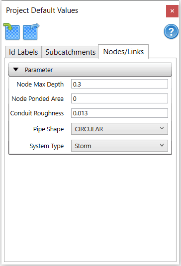
By using these defaults, VO SWMM eliminates the need for repetitive data entry, ensuring consistency and reducing the likelihood of errors across your drainage network.
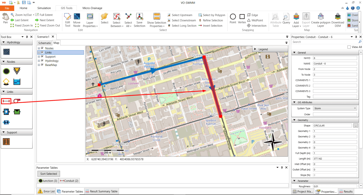
Tool #3: Automated Ground Elevation and Area/Length Calculation
After mapping your drainage components, VO SWMM provides powerful tools to calculate ground elevation, subcatchment area, and conduit length. By georeferencing your layer with a corresponding DEM, the system can automatically determine ground elevations at nodes and calculate areas and lengths where necessary. This automation enhances accuracy and efficiency, allowing engineers to focus on more complex design tasks.
Tool #4: Elevation Profile
The Elevation Profile tool offers a dynamic visual representation of the selected links and nodes within your drainage network.
By plotting Length and Full Depth for conduits, along with Full Depth for nodes, this feature provides a clear, graphical view of your system’s profile, helping to identify potential issues and ensure that your design meets all necessary specifications.
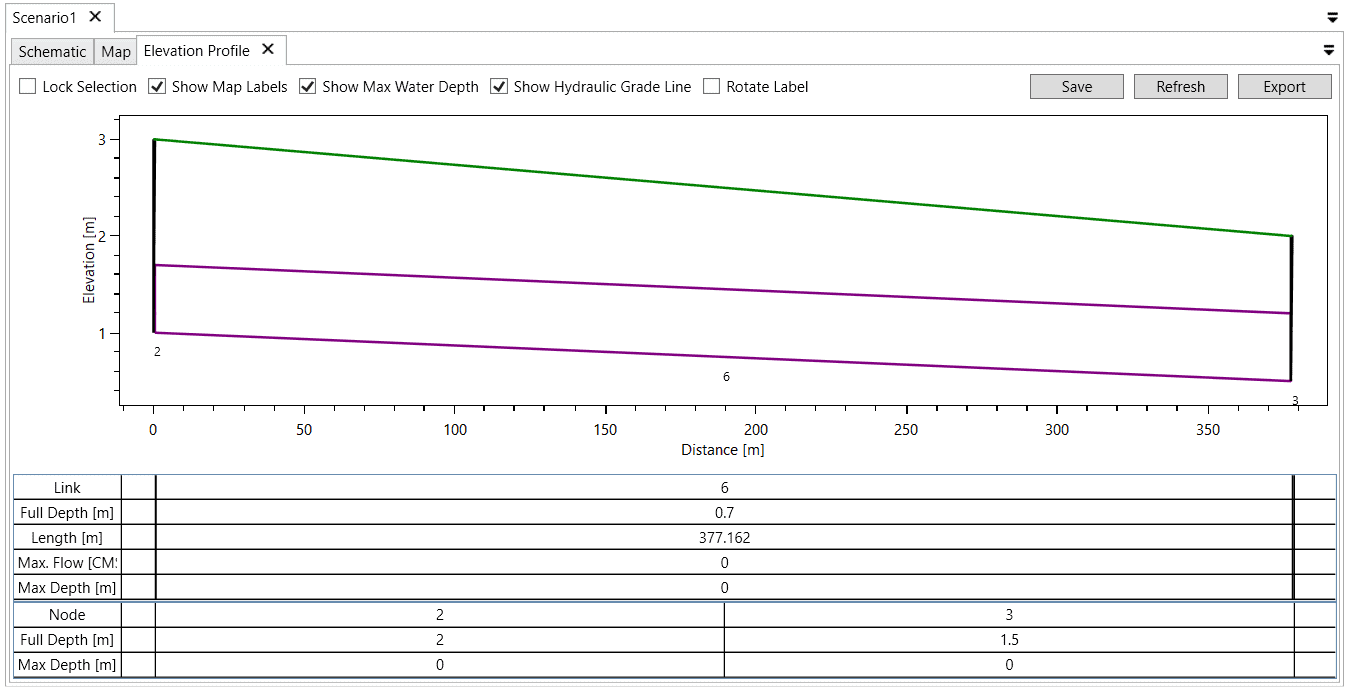
For detailed guidance on using this tool, refer to the VO SWMM manual.
Tool #5: Surcharge Analysis
Validating your design is crucial, and the Surcharge Analysis tool in VO SWMM makes this process straightforward. By applying predefined criteria, engineers can quickly assess whether nodes are operating within design parameters or require adjustments.
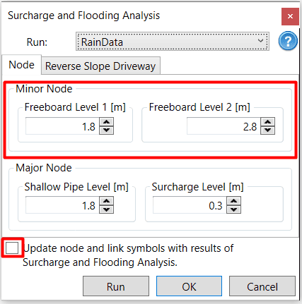
The tool categorizes nodes into four levels based on water level relative to critical thresholds, with each category represented by a specific coloured symbol (green, yellow, orange, or red circle dots).
For more information, explore the Surcharge Analysis section of the VO SWMM manual.
Conclusion
This suite of tools in VO SWMM is designed to simplify and enhance the design of minor drainage systems, providing engineers with the precision and efficiency needed to tackle complex modelling tasks.
Dive into these features to optimize your next Dual-Drainage project.
To request a VO license, click here