
Updating the Humber River Model for Watershed-Scale Decisions

Watershed Hydrology and Flood Planning

Updating the Humber River Model for Watershed-Scale Decisions

TRCA retained Civica Infrastructure to update, calibrate and apply a detailed VO model across the Humber River watershed.

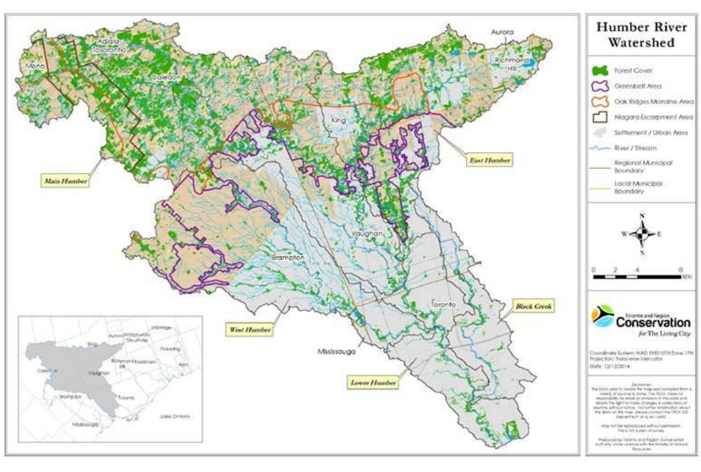
Humber River watershed study area
Humber River watershed study area. Source: 2015 project report.
Project owner TRCA
Consultant Civica Infrastructure Inc.
Watershed area 903 km²
Core reports 2015 model update and 2018 future-conditions update

The Challenge

The Humber River watershed is large, urbanizing and hydrologically diverse. TRCA needed an updated watershed model that could reflect current conditions, use available monitoring data and support future flood-planning decisions.

Objectives
Update the watershed model to reflect current land use and drainage conditions.
Calibrate and validate model performance using available rainfall and streamflow monitoring data.
Apply the model to assess future conditions and support watershed-scale flood planning.
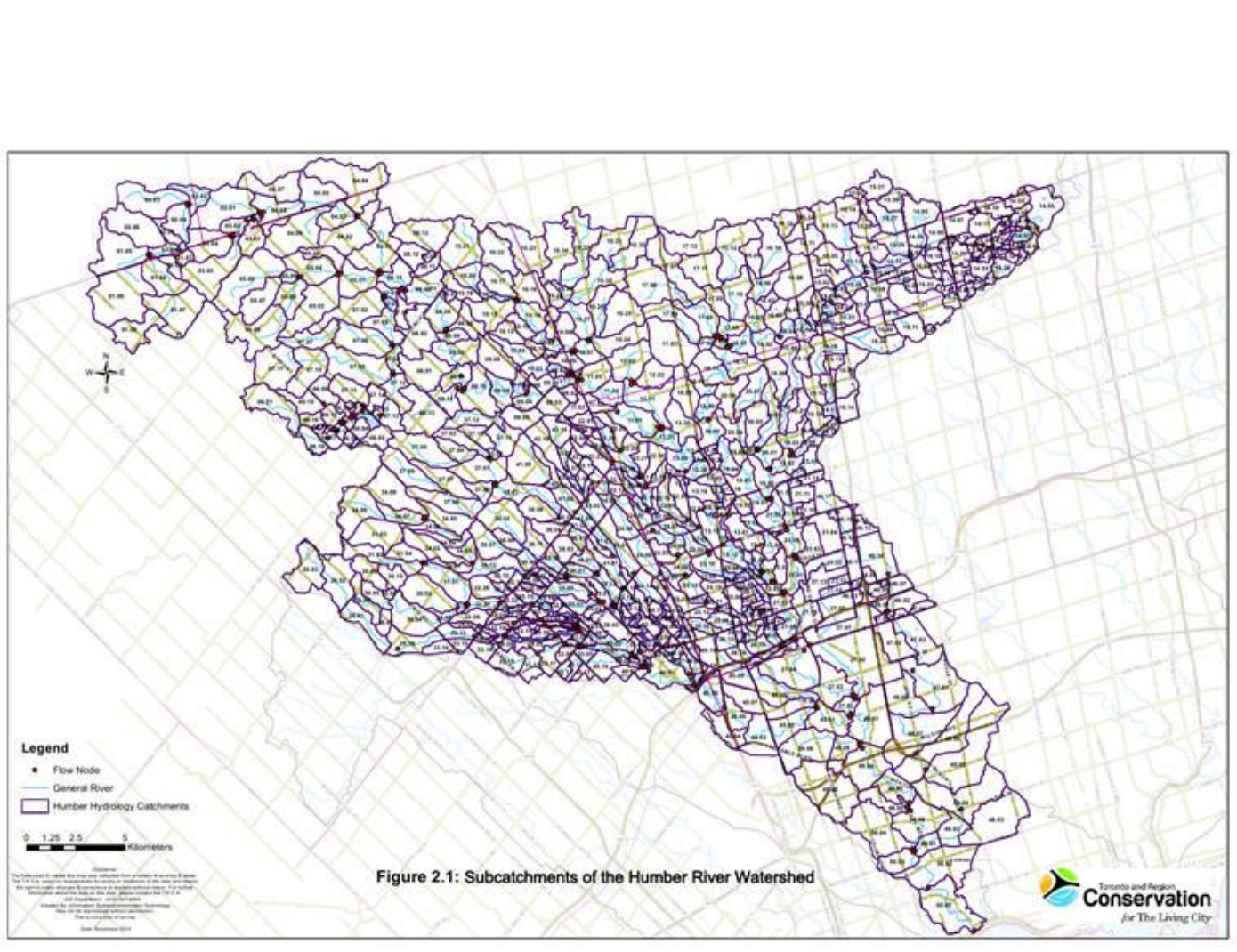
Humber River model showing 714 subcatchments
714-subcatchment Humber River model. Source: 2015 project report.

How VO Was Used

Civica used VO to build and update a detailed hydrologic representation of the Humber River watershed. The model incorporated hundreds of subcatchments, channel elements and reservoir elements so rainfall-runoff response and watershed routing could be assessed across the system.

714 Subcatchments
768 Channel elements
81 Reservoir elements

Evaluating Future Conditions

The updated model was also used to assess how future land-use conditions could affect peak flows across the watershed. This allowed the project team to compare modeled future conditions against the existing-condition baseline at key locations.
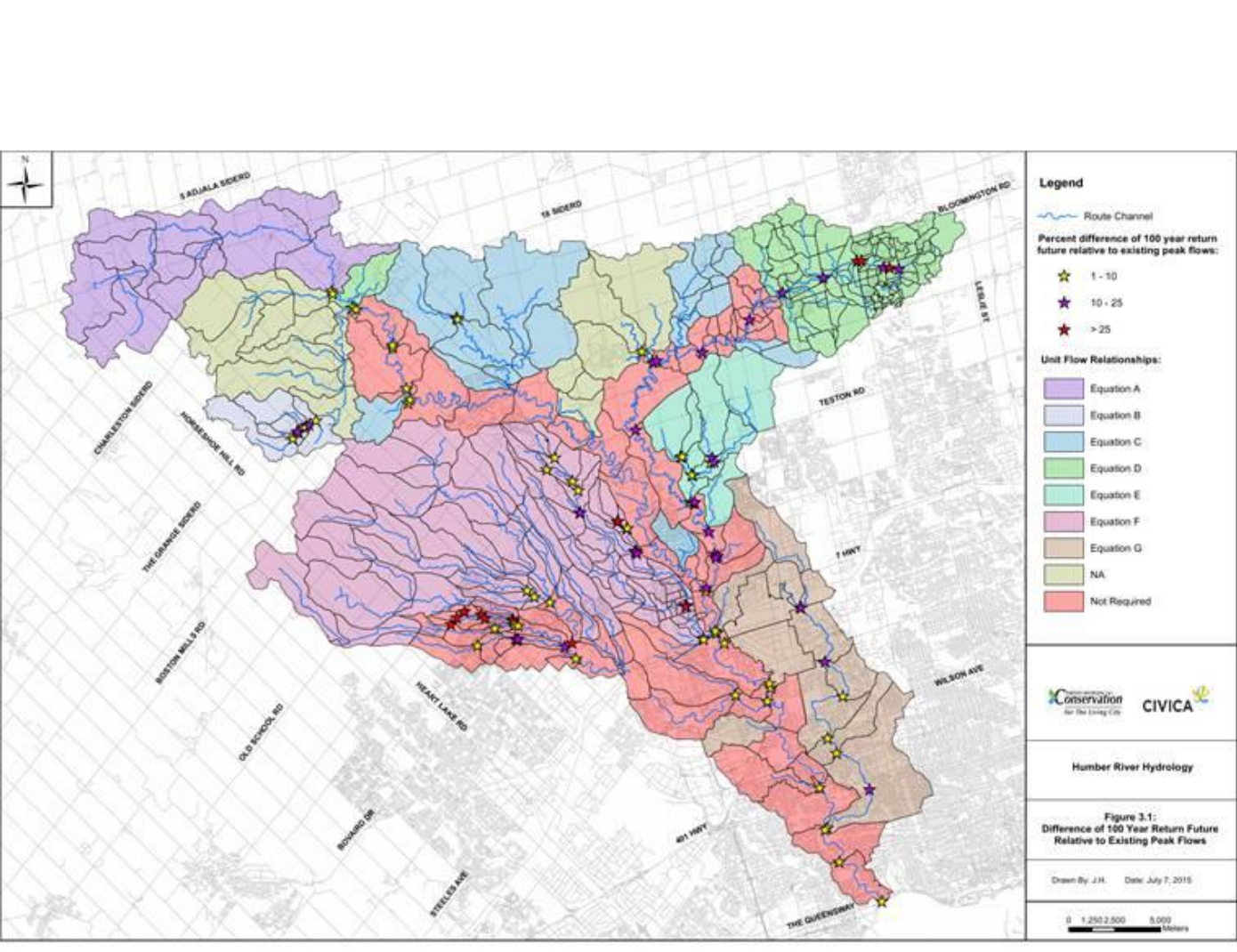
Change in future-condition Humber River peak flow
Change in 100-year future-condition peak flow relative to existing conditions.

Calibration Grounded in Monitoring Data

Rainfall and streamflow monitoring data were used to support calibration and validation of the watershed model. This provided a measured basis for reviewing how well the model represented observed watershed response.
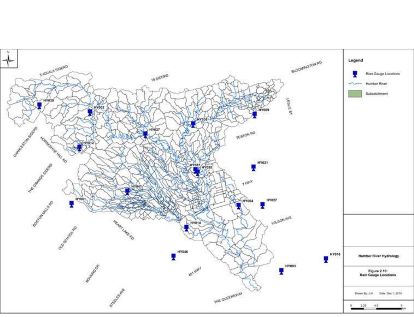
Rain gauge locations used for Humber River model calibration
Rain gauge network used to support model calibration.
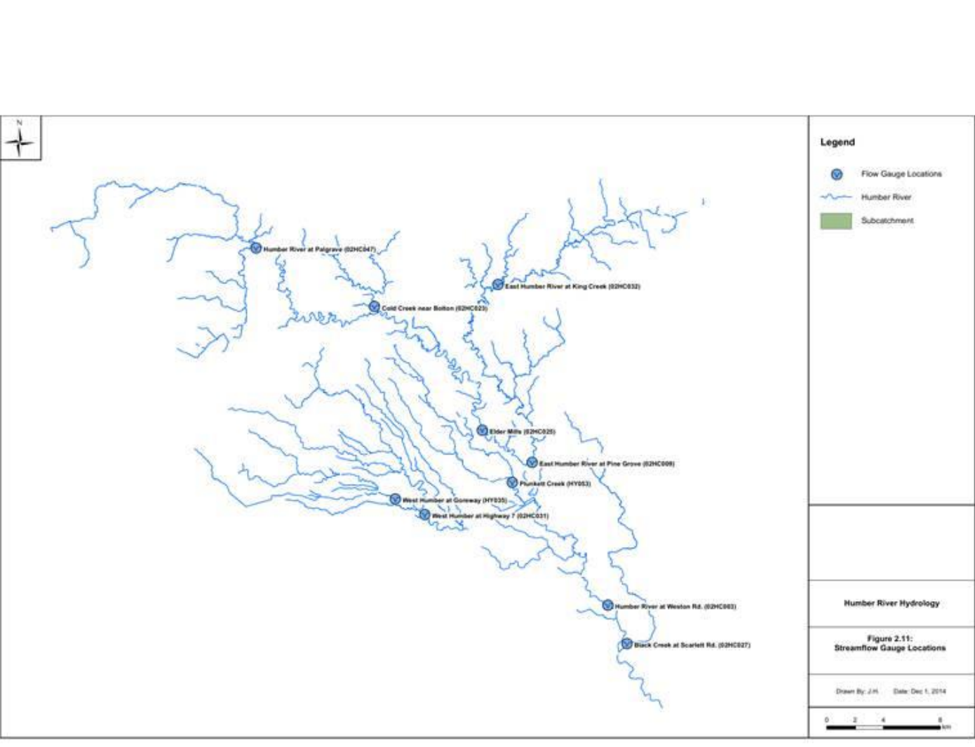
Streamflow gauge locations used for Humber River model calibration
Streamflow monitoring locations used to evaluate model performance.

Supporting Future Flood Planning

A maintained planning asset

The updated Humber River model provided TRCA with a detailed watershed-scale modeling framework that could be maintained and applied as land use, infrastructure and planning needs evolved.

VO provided a detailed watershed-scale model that could be calibrated against monitoring data, updated for future conditions and applied to ongoing flood-planning decisions.

Attribution: Project information is summarized from reports prepared by Civica Infrastructure Inc. for Toronto and Region Conservation Authority. Smart City Water supplied the VO software and did not act as the engineering consultant or project owner.